
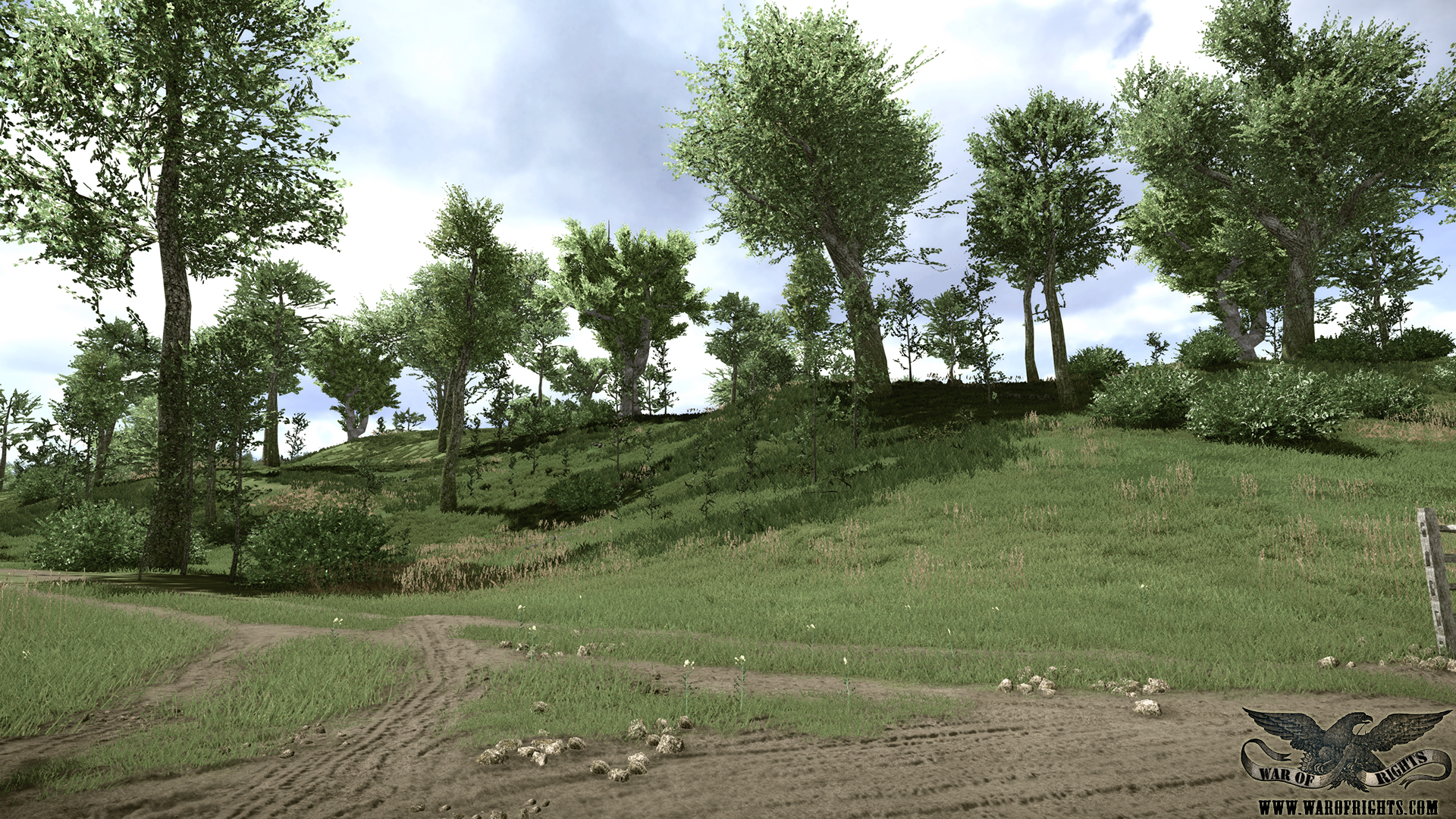
I've been to this location and the heights are much more drastic than this. Why isn't that represented in-game?Originally Posted by TrustyJam

Also, hello. First post here.


CSA Major


I've been to this location and the heights are much more drastic than this. Why isn't that represented in-game?
Also, hello. First post here.
CSA Lieutenant Colonel

I can't answer that question as I am not a developer. I can however say that was a screenshot from two and a half years ago.
"The patriot volunteer, fighting for country and his rights, makes the most reliable soldier on Earth." - Lieutenant General Thomas "Stonewall" Jackson
"It is well that war is so terrible. Otherwise we should grow too fond of it." - General Robert E. Lee
"I would rather die a thousand deaths than betray a friend." - Confederate Scout, Sam Davis
Brigadier General James J. Archer
Archer's Brigade
A.P. Hill's Light Division
Army of Northern Virginia
USA Brigadier General

So it could be not the newest one
USA General of the Army

First, Greetings and welcome to the forums.
Now concerning your question ... I've also been to the site, in fact I live a scant 60 miles from the battlefield now. It's a nice weekend trip.
However, if you have spent more time on this forum reading many posts, you'll find that due to limitations of the licensed engine, (Cryengine,) the developers were limited to a battlefield measuring 4.5 kilometers square, or about 2.5 miles square. Due to that, they've made some minor adjustments in mapping to fit the whole field on one map. So what you're seeing perhaps is the heights that are at the foot of the middle bridge, instead of the heights that are at the foot of the lower bridge, (Burnside's Bridge.) Those heights do not appear to be as dramatic as the heights around the Lower Bridge.
CSA Major
Ah, yes. I remember that just about all of the old bridges that cross Antietam look just like the infamous "Burnside Bridge". I used to live in Fredericksburg, VA and went to many of the battlefields in the Eastern theatre and in the Shenandoah.
I appreciate the well-explained and polite answer.
Second Lieutenant Douglas L. Landree
Platoon Commander
30th VA Vol. Inf. Regt. Co. A "Washington Guards"

Hello everyone! This is my first post.
These all look great!
USA General of the Army
Thanks, and welcome to the site!
CSA Brigadier General

Welcome to the forums!


There is lack of screenshots and videos! Can you please me? <3
Southern men the thunders mutter!
Northern flags in South winds flutter!
To arms! To arms! To arms!
IN THE DIXIE

When its time for a new screenshot or a new video, you will see it here..
 Posting Permissions

 Reply With Quote

